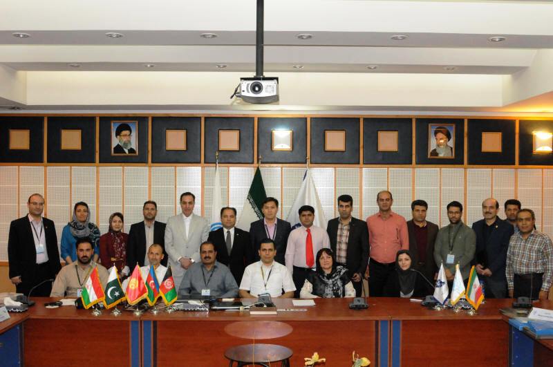
,‹The 2nd ECO Geomatics Committee Training Course on Unification of Height Datums (Gravity Potential Approach) was organized on 22-27 July 2017 in Tehran. Jointly held by the National Cartographic Center (NCC) of the Islamic Republic of Iran and ECO Secretariat, the Training Course was attended by representatives from the Islamic Republic of Afghanistan, Republic of Azerbaijan, Islamic Republic of Iran (host), Kyrgyz Republic, Islamic Republic of Pakistan, Republic of Tajikistan as well as ECO Secretariat.
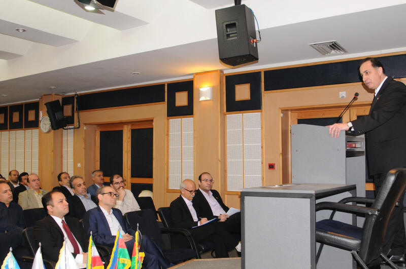
The Training Course was inaugurated by Professor Dr. Alireza A. Ardalan, Director General of NCC of Iran and Secretary of the ECO Geomatics Committee and Mr. Seyed Jalaledin Alavi Sabzevari, ECO Deputy Secretary General. In his opening remarks, NCC Director General expressed his profound gratitude to the ECO Member States and ECO Secretariat for their active contribution and participation in the second consecutive capacity building Training Course on Unification of Height Datums. He underscored the importance of collective efforts in the ECO Region in boosting capacity building, sharing know-how and best experiences, as well as dissemination of scientific knowledge on mapping and geomatics and other related spheres. Dr. Ardalan added that this exercise will certainly act as a catalyst in formulating regional plans and programmes to prevent and mitigate the effects of disasters in ECO Member States, as well as will lead to enhanced sustainable socio-economic development in the ECO Region in line with UN Development Agenda 2030 and ECO Vision 2025. He also called upon the Member States to consolidate their efforts for further enhancing the regional collaboration under the established mechanism of ECO Geomatics Committee.
Mr. Seyed Jalaledin Alavi, ECO Deputy Secretary General, in his inaugural remarks underlined the importance of training, capacity building and knowledge sharing among Member States and briefed the audience on ECO Vision 2025 with its priority and cross-sectoral areas for future cooperation, as adopted by the 22nd ECO Council of Ministers (COM) in February 2017 in Islamabad. He asserted that ECO Vision 2025 was developed as per requirements and needs of the Member States while having in mind the global processes such as UN Development Agenda 2030, Paris Agreement on Climate Change and Sendai Framework on Disaster Risk Reduction. ECO Deputy Secretary General emphasized on the role of geomatics and mapping in the ECO Region as instrumental for successful regional cooperation in sectors which involve effective natural resource and land management systems and policies. He also called upon the Member States to host/co-host similar capacity building training courses in future with a view to maintaining momentum for synergic and coherent cooperation among Member States for effective implementation of the ECO Vision 2025.
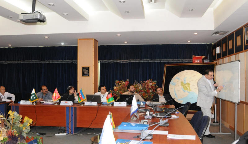
In the course of the training programme, the participants visited different departments/structures of NCC of Iran and became well-versed with main activities, functions and capacities, including land registry services, cadastre services, map and atlas services, GPS and archive services and others.
During the 5-day long programme, the participants actively were engaged in different theoretical and practical training sessions and studied various topics, inter alia, overall concepts of height datums and their unifications and computations, gravitation measurement & corrections, geodesy, tide gauges and related calibrations, satellite altimetry observations, global navigation satellite system (GNSS), GPS, geoid, sea surface topography and mean sea level computation. They also learned from the chief instructor and other instructors of NCC the technical formulas and test data for solving the mathematical equations through online Geo and Matlab Softwares.
At the conclusion of the Training Course, the participants considered Training Course extremely fruitful and recommended that similar capacity building and sharing best practices training courses may be continued. The NCC of Iran offered to host or co-host with other Member States a number of training courses in 2017/2018 with the designated topics such as Spatial Data Infrastructure; Scientific GNSS Data Processing; Local Geodetic Datum; Regional Deformation Study of the Earth; Orthophoto Generation, Cadastral, Cartographic Maps and Atlas Production.
The participants also developed some recommendations for future, including the establishment of ECO regional portal for sharing data on disaster management; designing the ECO disaster risk maps; establishment of geodetic datums of different types i.e. gravity datum, 3-D geodetic datum, and height datum for carrying out joint activities at regional level; pragmatic contribution of the ECO Geomatics Committee into the work of the ECO policy-making bodies and implementation of ECO Vision 2025; contribution of ECO Geomatics Committee to implementation of the UN Development Agenda 2030 in ECO Region; and extension in term of current Secretary of the ECO Geomatics Committee by the 28th ECO Regional Planning Council Meeting (December 2017).
At the conclusion of the training course, all participants were awarded with Certificates of Appreciation and Completion.